
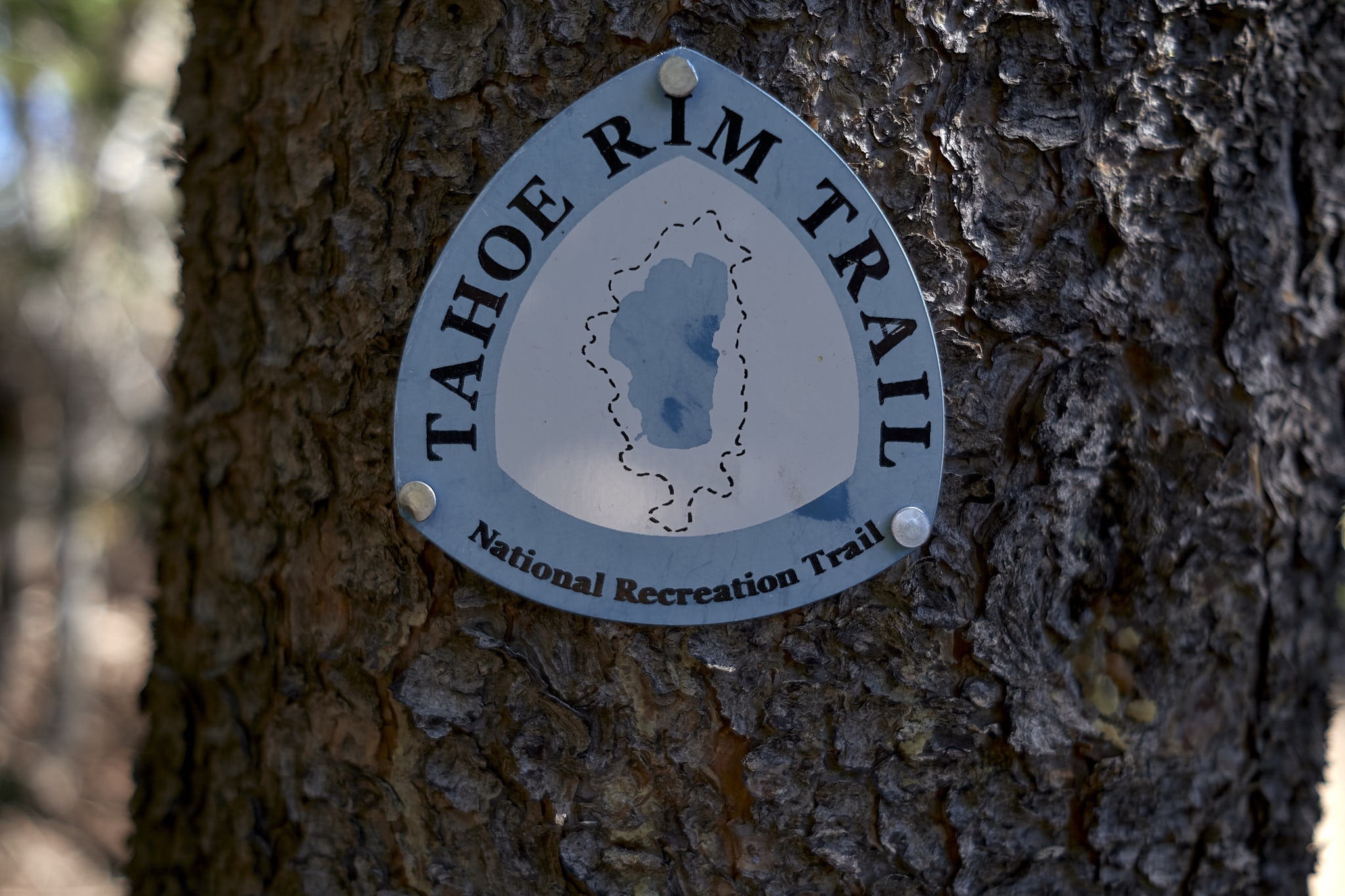
tahoe rim trail map/track that i created and used: https://caltopo.com/m/B08U1

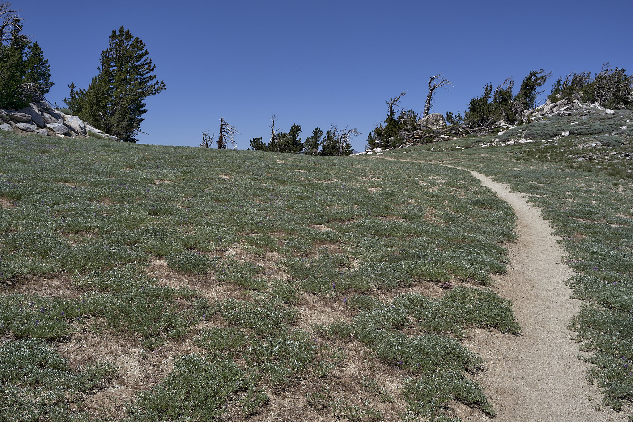
day 1 (0.5)
as is typical clint fashion, i didn’t really eat anything on the last day of my bus ride to reno. it wasn’t intentional. i kept waiting for a stop where there would be actual food and not convenience store crap. the last stop was at a convenience/liquor store. nothing substantial to eat there. once the bus pulled away, it became evident that just around the corner was a subway. and of course, once in reno, there was nothing near the bus stop that was not a casino. in the end, no food would be a problem late on the first day.
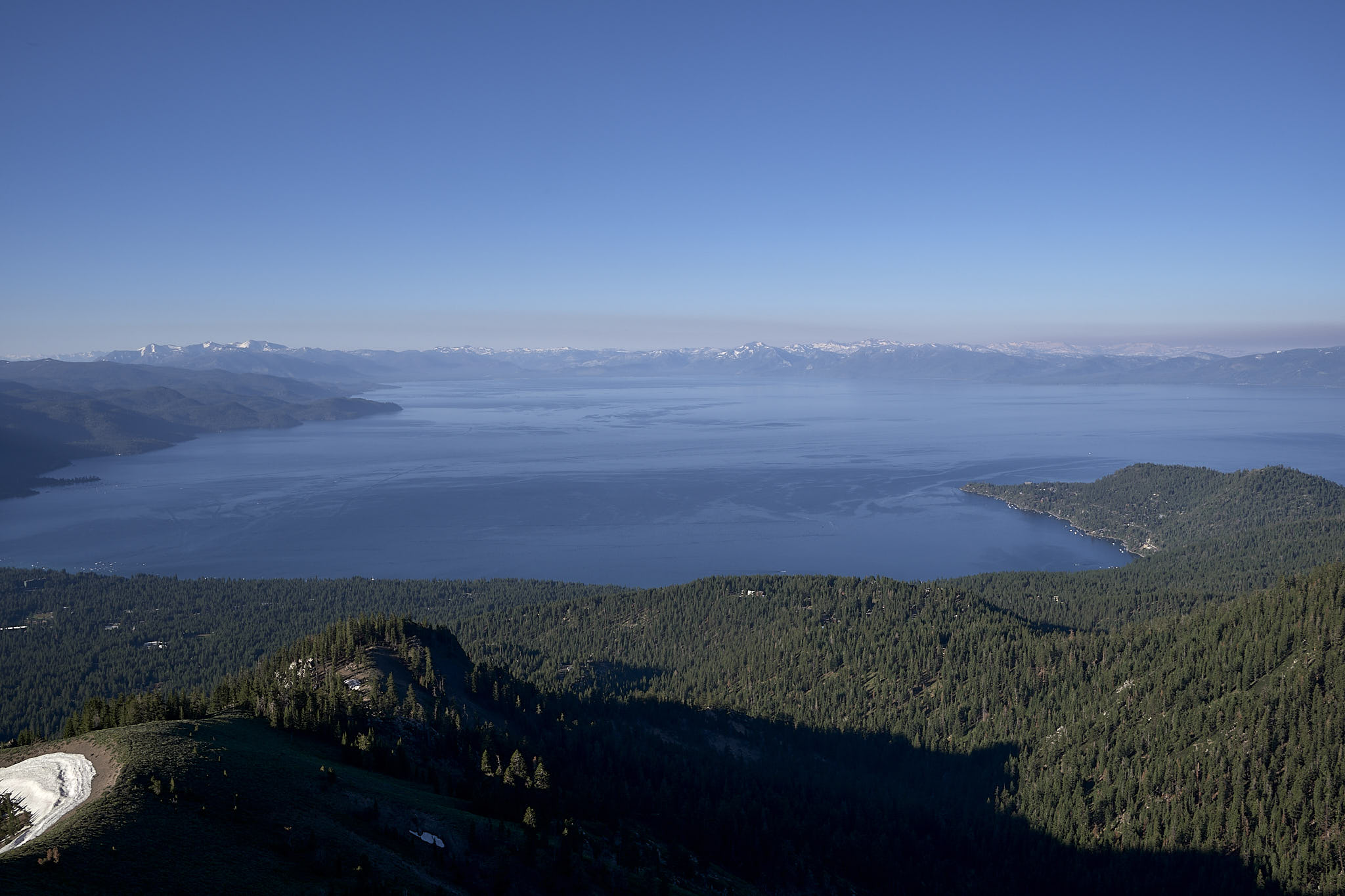
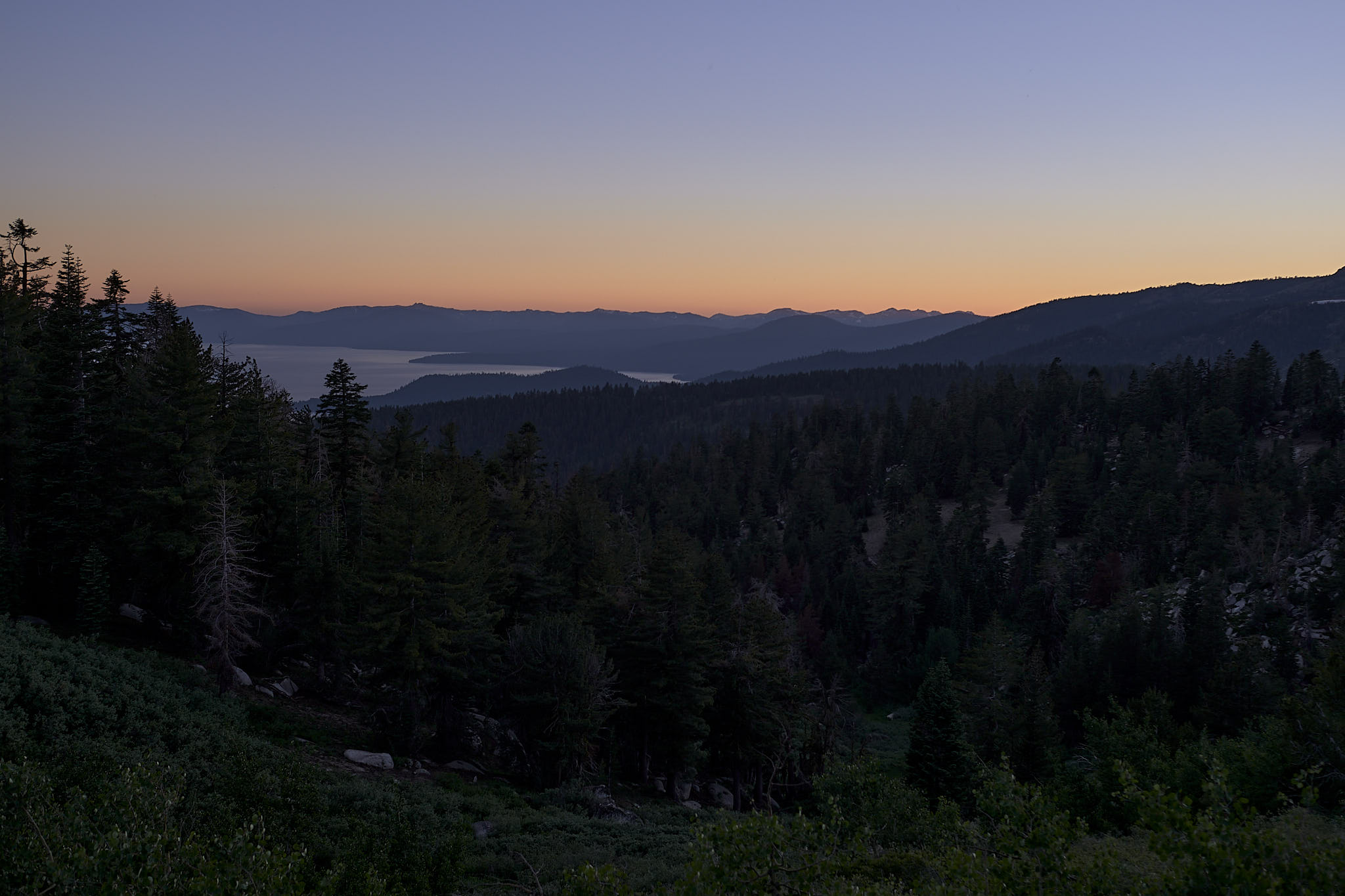
my intention was to start at the mt rose summit trailhead, but somehow uber routed me and my driver to the tahoe meadows trail head. i was sort of glad this happened as it was an easier place to end the hike, if only a mile from my planned start. the snow on the parking lot as i began was prophetic, though like most prognostications, the importance was lost on me until i was deep in the thick of things. again, probably best that way.
my original thoughts for this hike had me doing 20 miles on day 1. i had figured that there would be some night hiking, but that was ok with me. unfortunately, i got to the trailhead at 15:00 instead of 14:00. i was already in the hole at least 2 miles if not more. no problem, i said to myself, a mile or two is fairly easy to make up over 5 days.
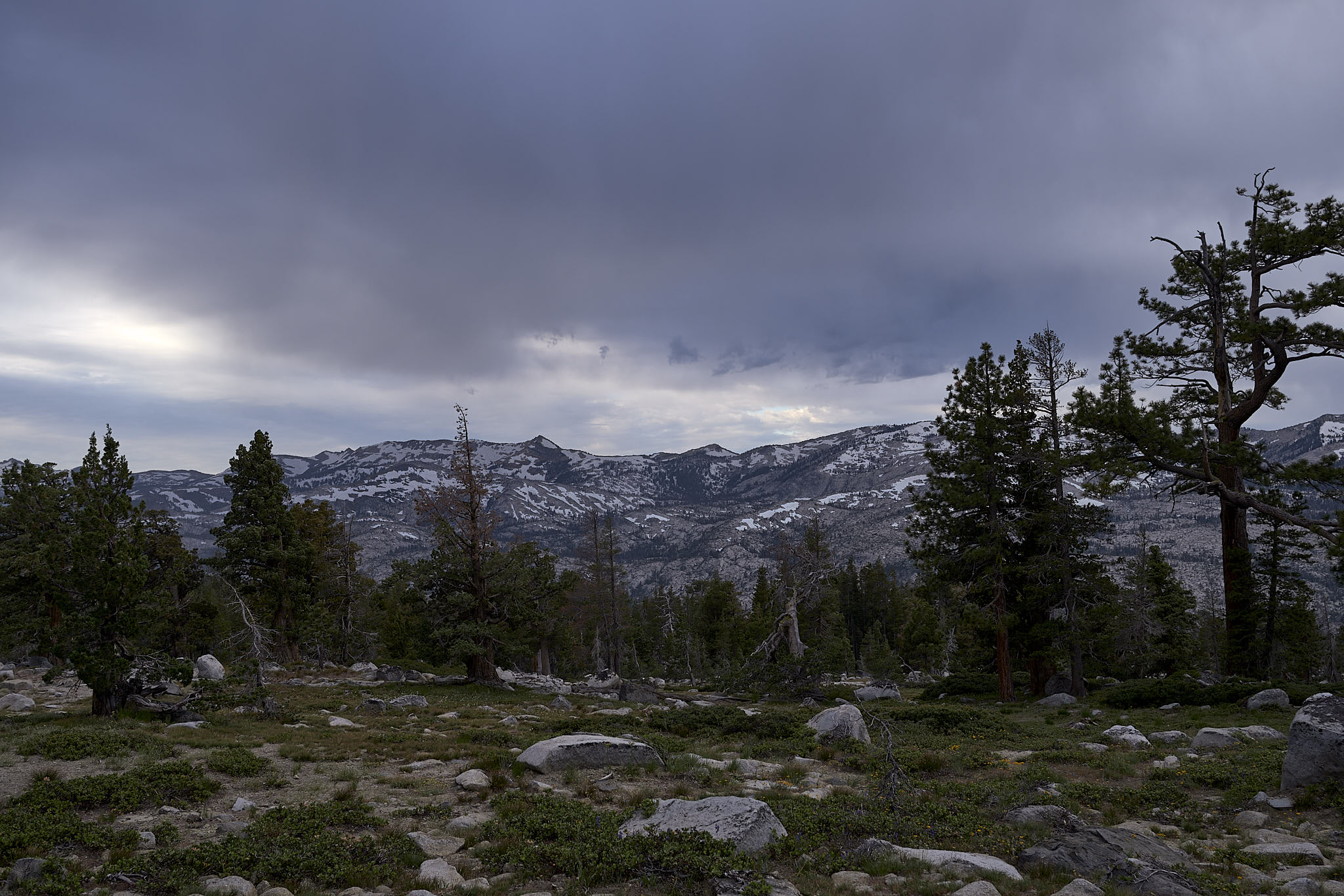
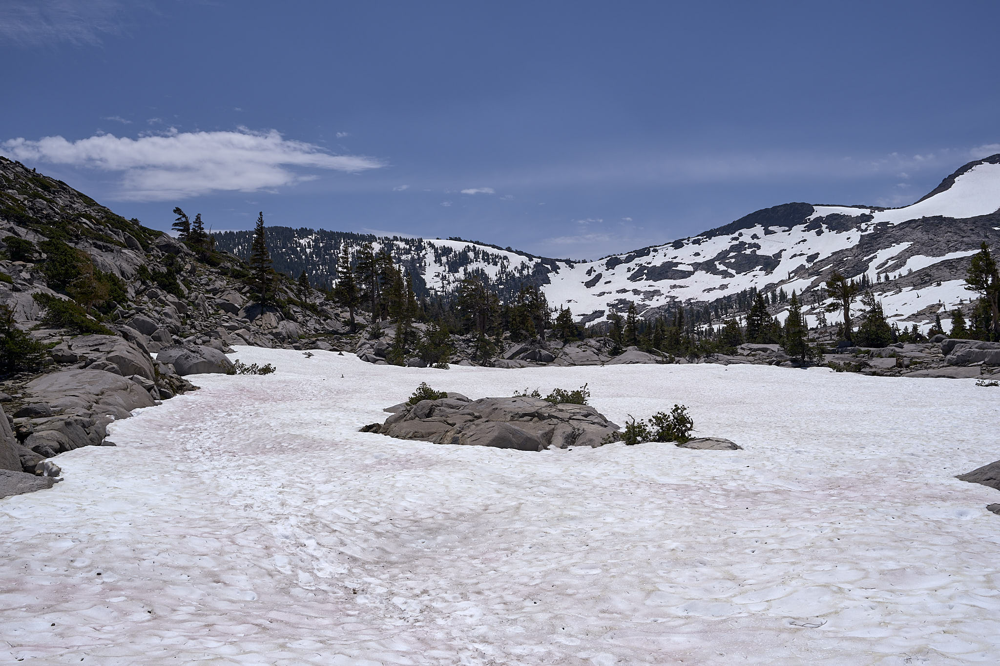
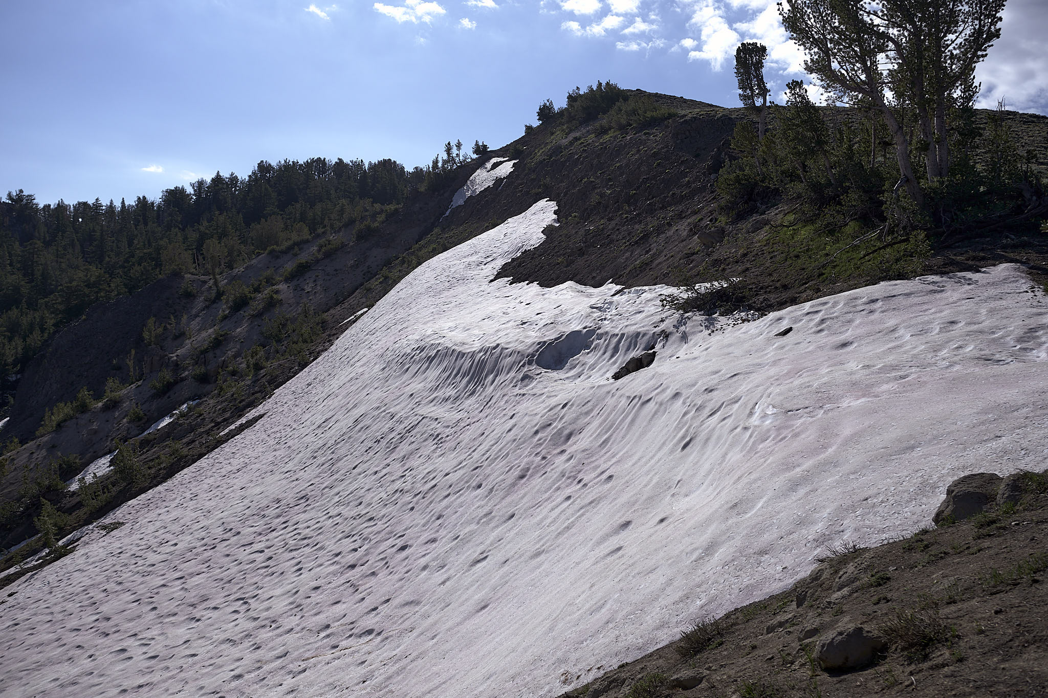
as i hiked up relay peak, it became evident that i was not going to be making quick progress. snow was piled on the slopes. i was kicking in snow steps and going under small trees that had been bent across the trail from the mass of all the snow that had fallen this winter. my legs were quivering from walking bent over with a full pack and 3 liters of water. every muscle in my body was tensed up in an attempt to keep from making a misstep and sliding down the steep, snowy slopes.
fatigue soon set in and i began to feel slightly nauseous. awesome, i said to myself. i had only been hiking for about 3 hours. my energy waned as the snow continued. i tried to eat something, but it was a chore.
i cleared the snow around 20:00. i stopped for a short break and thought about pushing on. darkness was setting in and i wasn’t exactly sure that i had the desire to push through more snow on steep slopes in the dark with no energy and a headlamp. i decided to find a suitable tent site and call it a night. only 5 hours of hiking. i was too tired and exhausted to be disappointed.
daily mileage total: 11.1
trail total: 11.1
day 2 (1.5)
i woke refreshed to a gorgeous sunrise.
the mountain air was cold and i started the morning hike with my puffy on. within 30 minutes of hiking, i encountered more snow fields on mountain slopes. i definitely made the correct call when i stopped early the prior night. there was no way i was capable of crossing this stuff at night with no energy and nausea. i shed my puffy, donned my trekking pole, and got after it. the “treacherous” crossings soon subsided and it was just plain hiking on snow. i found my groove and everything went well.
daily mileage total: 30.6
trail total: 41.7
day 3 (2.5)
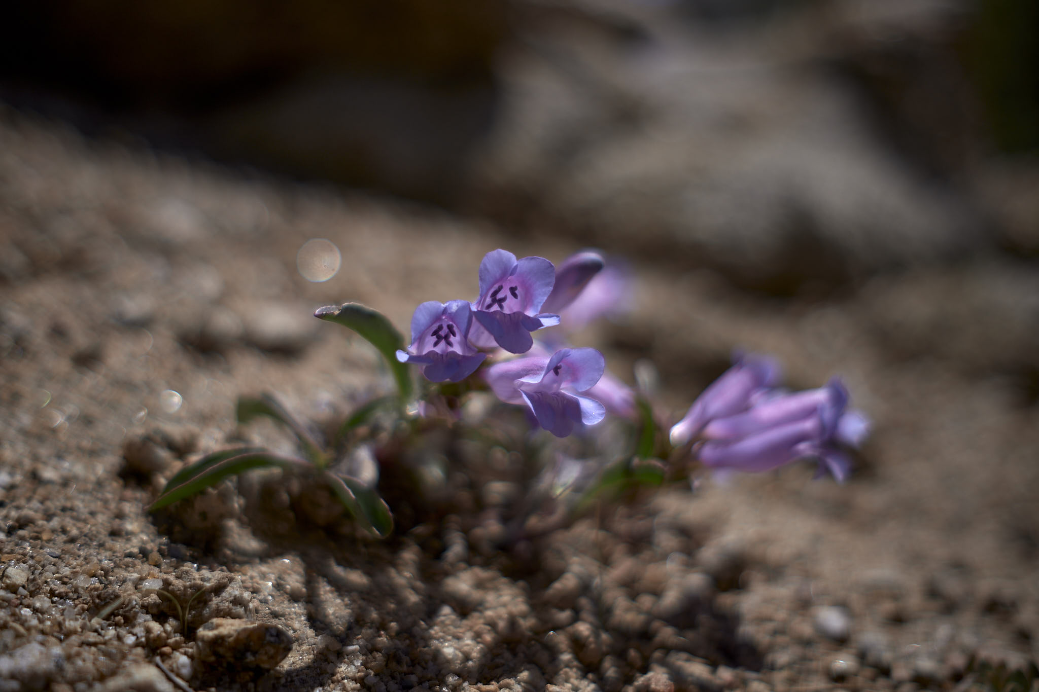
this day saw the rise of the mosquitos. they got pretty bad. ok, really awful. wet alpine meadows were the cause.
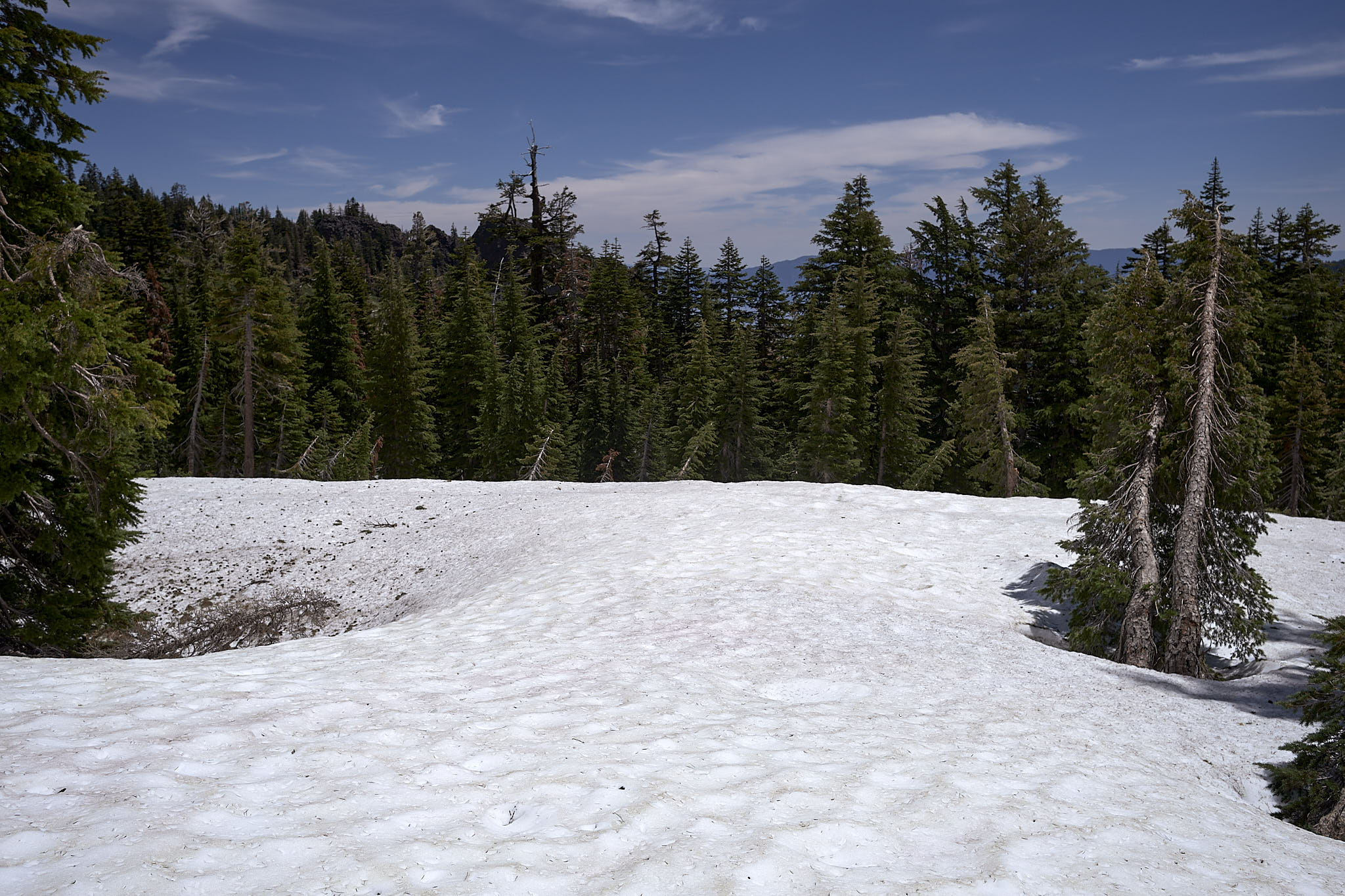
plenty of snow fields to cross, but nothing too bad. the occasional slope crossing which meant kicking in snow steps. i had always heard hikers say they prefer to hike on snow in the morning when it is hard. i found that only applies if you have crampons or microspikes. i didn’t have those. i preferred the soft, slushy stuff. it was easy to kick steps in and compacted nicely into a secure perch for my feet. so, there you go.
i stopped a bit short this night as i arrived at the north boundary of desolation wilderness. an overnight permit and a bear can are both required to stay the night. i had neither, by plan, and would have to hike all the way through the next day. an overnight stay in the wilderness requires an overnight permit which can only be had through recreation.gov. thanks, but no. day use permits were supposedly available at the wilderness entry points. i can confirm they are available near the south boundary. specifically at the information stand at echo chalet before you actually enter the wilderness. they are not available at the north boundary.
daily mileage total: 25.3
trail total: 67.0
day 4 (3.5)
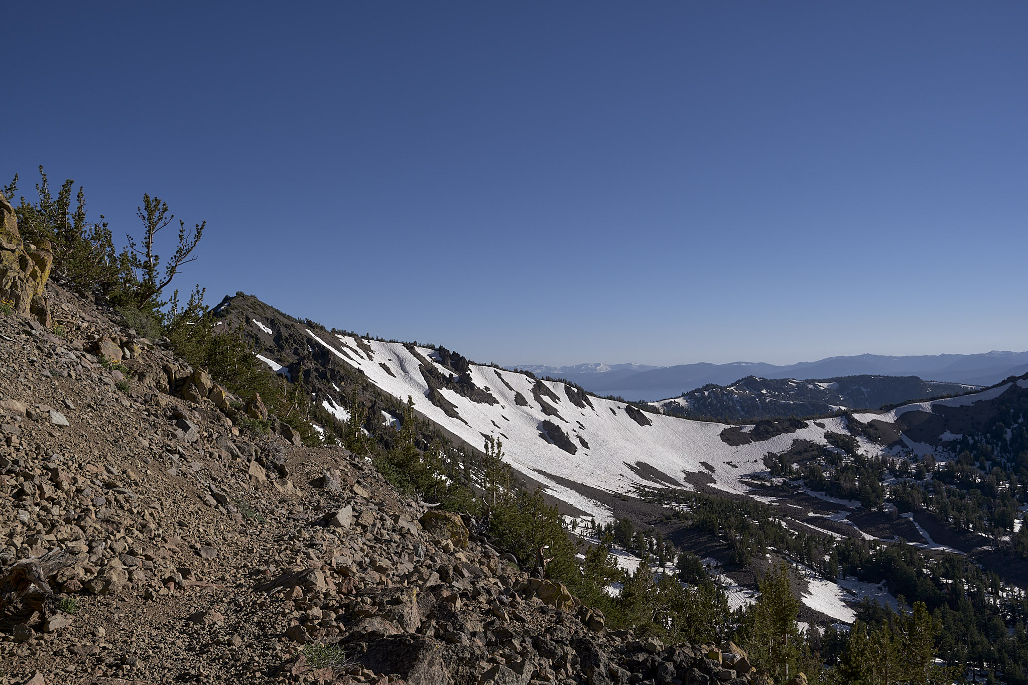
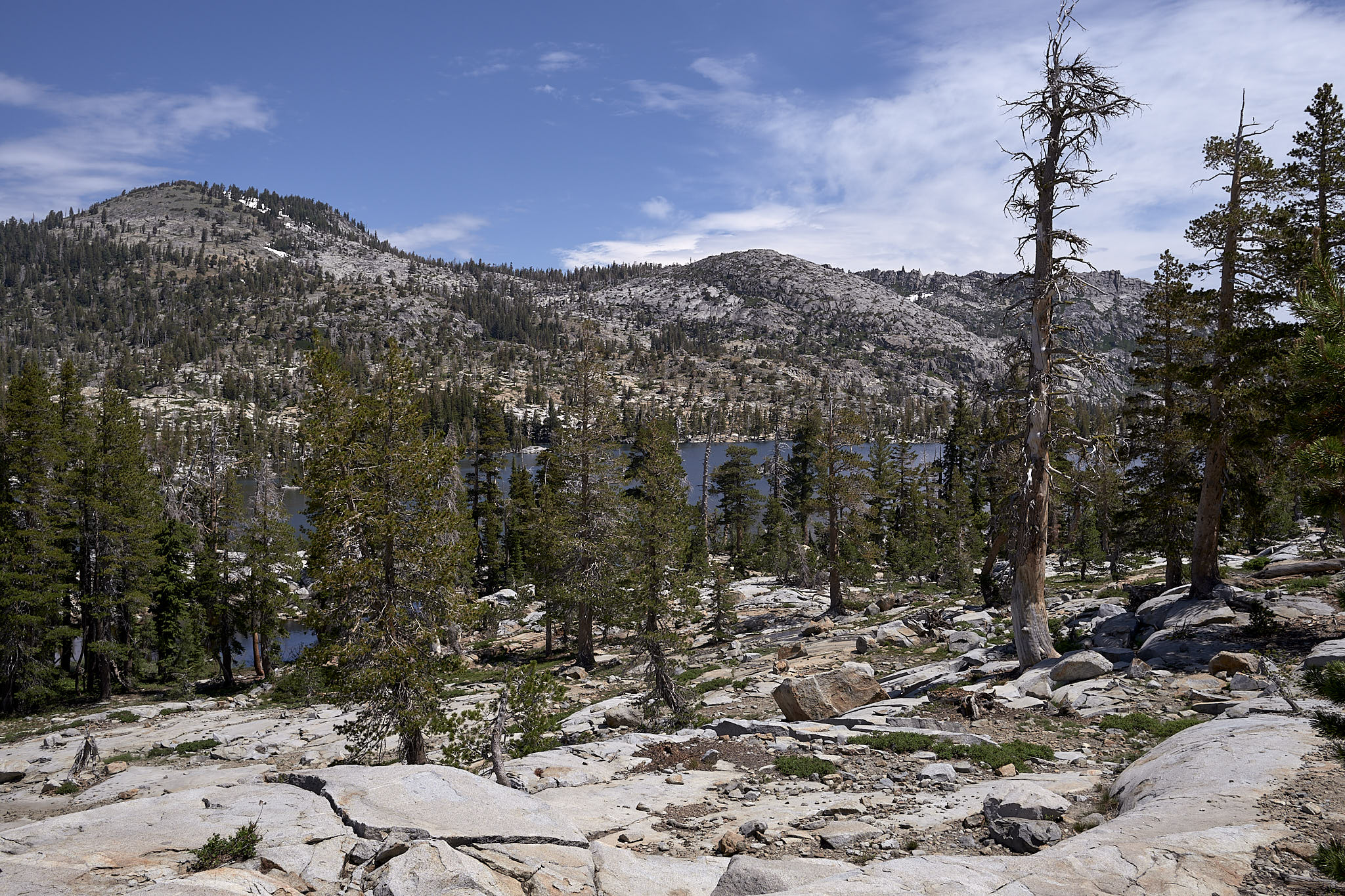
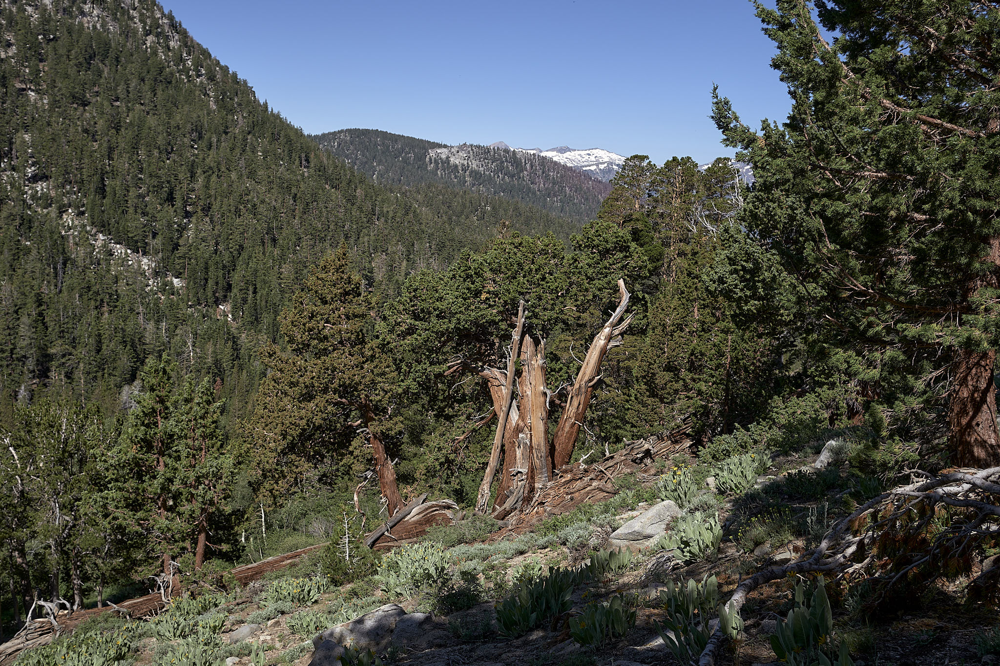
it was time to enter desolation wilderness. passing hikers had already provided ample description of the snow that was to be encountered there. most all (the dozen or so that i came across) agreed that it was a lot, but nothing that was impossible. dick’s pass was the worst of it. but, look at them, they had made it through. it might, however, be a little tougher since i was going up dick’s pass and they were all going down.
the first several miles of the wilderness were pretty much like all the trail i had completed in the preceding 2 days. some snow. trees. easy hiking. some route finding. nothing really special.
other than mosquitos. seriously. mo. skeet. toes. thousands and thousands. if i slowed even a bit, they swarmed. i finally donned my head net and rain pants to keep them at bay. sweaty legs was orders of magnitude better than a hungry horde of mosquitos attacking every each of exposed flesh.
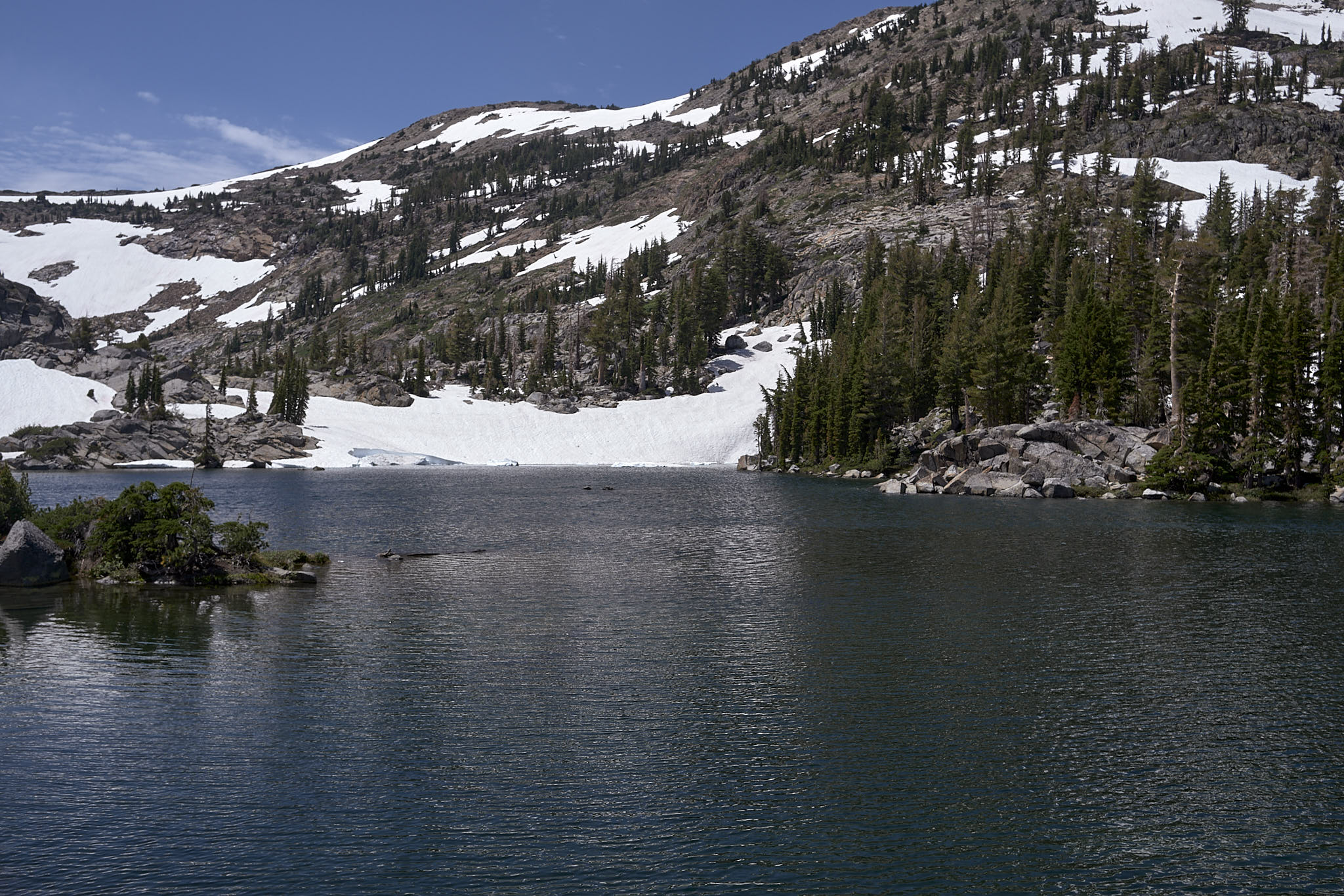
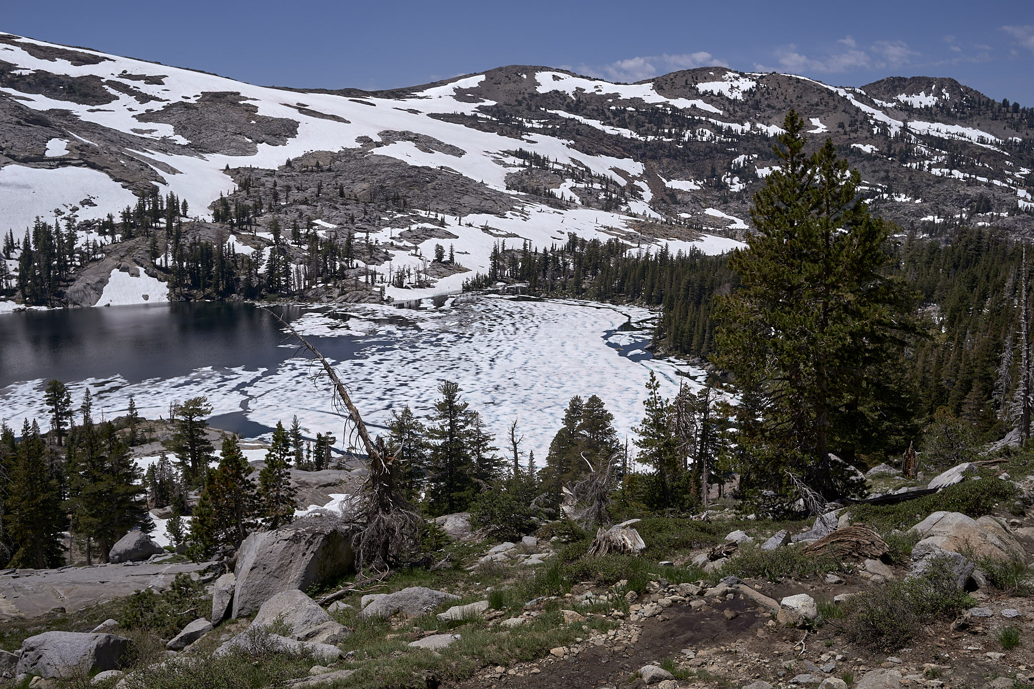
then i arrived at fontanillis lake. the mosquitos had abated. and what a beautiful sight. there were literally small icebergs floating in the lake. i had to cross a torrentially flowing creek at the head of fontanillis lake. it was mid-thigh deep and frigid. i wasn’t in the water for more than 30 seconds and my legs started to numb. i’ve never been in water that cold. i saw immediately how fast hypothermia can set in.

next up was dick’s lake and then dick’s pass. this part of the trail was no joke. it was completely covered in snow. i’m not sure how many snow covered miles i hiked, but the elevation went from around 8300 feet to almost 9400 feet. i think it took me a couple of hours to cover 2 miles. i really wasn’t tracking. i put my head down and hiked up. the fortunate part of all the snow was that switchbacks no longer mattered. the whole side of the mountain was covered in snow, so the easiest and fastest way up was straight with an occasional side track to avoid a tree or a really sketchy snow area.
going over dick’s pass was, symbolically, the beginning of the second half of the trail. it was and had been the toughest part of the trail. there was still more snow to come, but nothing this challenging.
susie lake had some snow around it, but it was mostly flat terrain. the trail on the north side of heather lake went right down to the water’s edge. the mountain on my right, a thin foot, maybe foot and a half of single track at my feet, then the water of the lake lapping at the trail edge at the left.
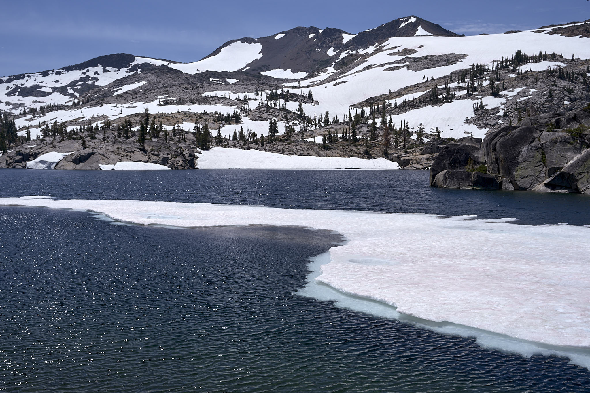
lake aloha had a significant amount of snow around it, but it was all easy hiking. the only issue here was hidden snow bridges. at the water’s edge i could hear large sections of the snow/ice shelf calving off into the lake. i could also see large caverns developing under the snow. i stepped through one snow bridge and luckily only went about a foot into cold water. after that i did my best to stay as far away from the snow/water edge as possible. hiking across these large snow fields was actually enjoyable.
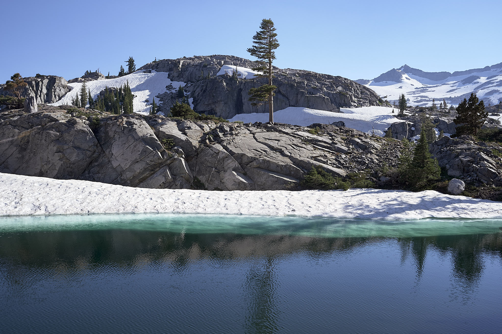
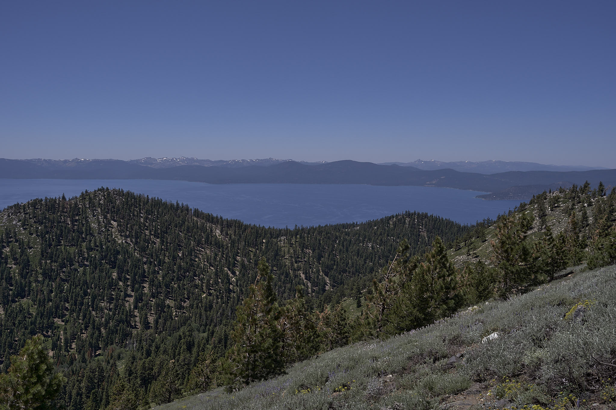
and there were gorgeous views of upper lake echo and lower lake echo.
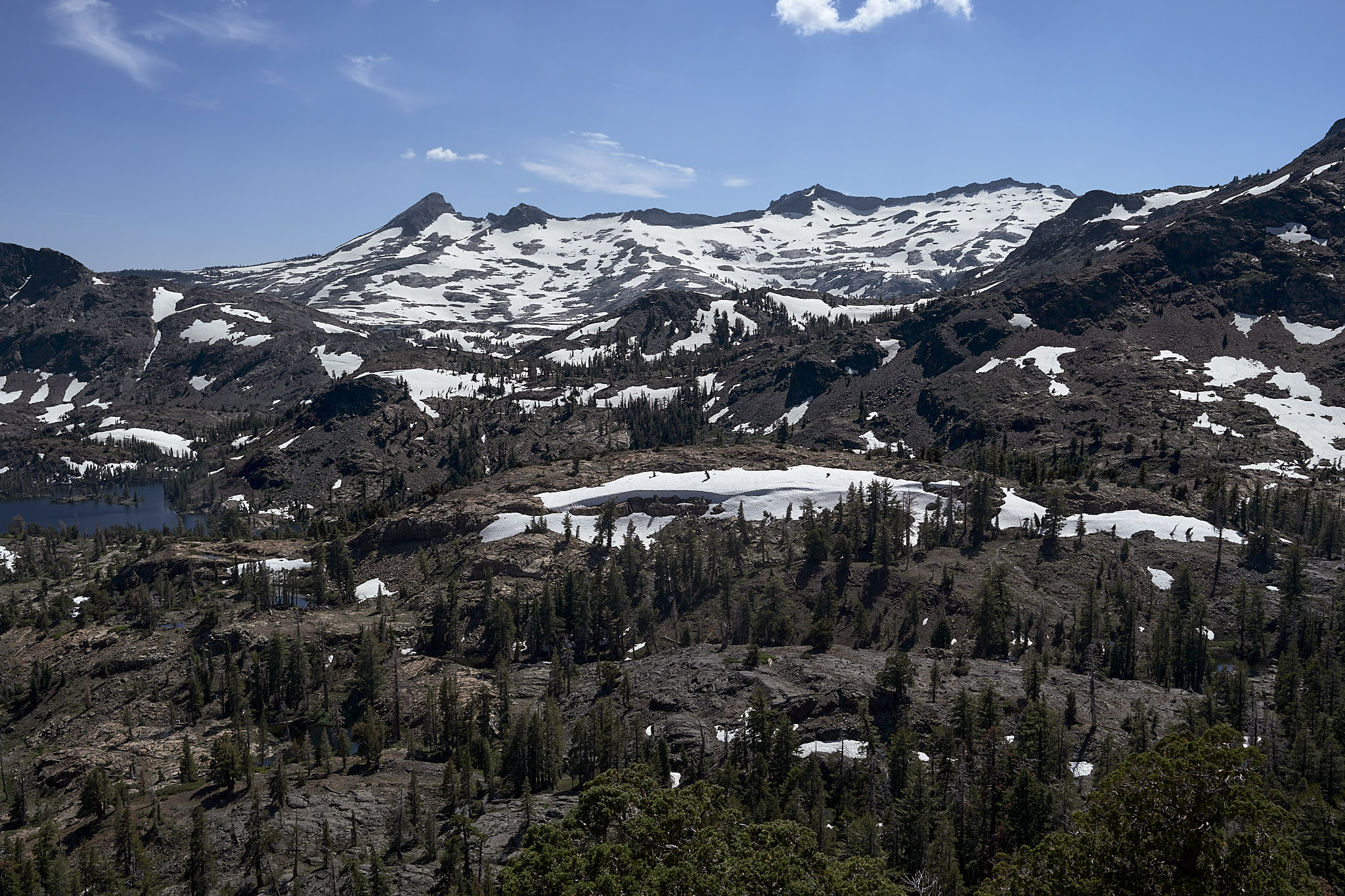
that pic immediately above with the lone pine tree and the blue ice under the water has to be my favorite pic from the entire hike. it is also my favorite view. it was literally breathtaking. like the tree, i was alone in this spot. i, maybe for a minute of two. the tree much longer. i think it was the along the shore of lower lake echo. the actual location doesn’t really matter. wherever there was. it was where i was in that moment.
i easily made it through the wilderness in a single day even with all the snow. the issue is that there is no camping between the south boundary and US50 which adds a few more miles to the hike. this is due to the fact that the two echo lakes have cabins on the shores and i’m sure that wealthy vacationers don’t want a bunch of hiker trash staying in their backyards.
daily mileage total: 29.2
trail total: 96.2
day 5 (4.5)
this was the day i realized that i was not going to complete this hike in 5.5 days like projected. i was going to need another day. so, the first thing i did once i got hiking and had some cell service was reschedule my bus trip home.
there was some snow this day. and my most challenging snow traverse. i didn’t snap any pics. but it involved crossing part of a snow bank on a slope then dropping down 8 or 9 feet into a crevice between said snow bank and the sheer rock face of the mountain. then pulling myself up 9 or so vertical feet using some dead bushes that were hanging down into the crevice at the end of the snow bank. this was all because part of the snow bank was shaded and hard packed ice. thus i could not kick snow steps in. see my earlier comment about preferring soft snow versus hard snow.
of note, this was also the day that i left the pacific crest trail and turned north. on the west side of lake tahoe, the tahoe rim trail and the pacific crest trail are co-joined for about 50 miles through the northern sierra nevada mountains. the trail got much easier after this.
daily mileage total: 23.9
trail total: 120.1
day 6 (5.5)
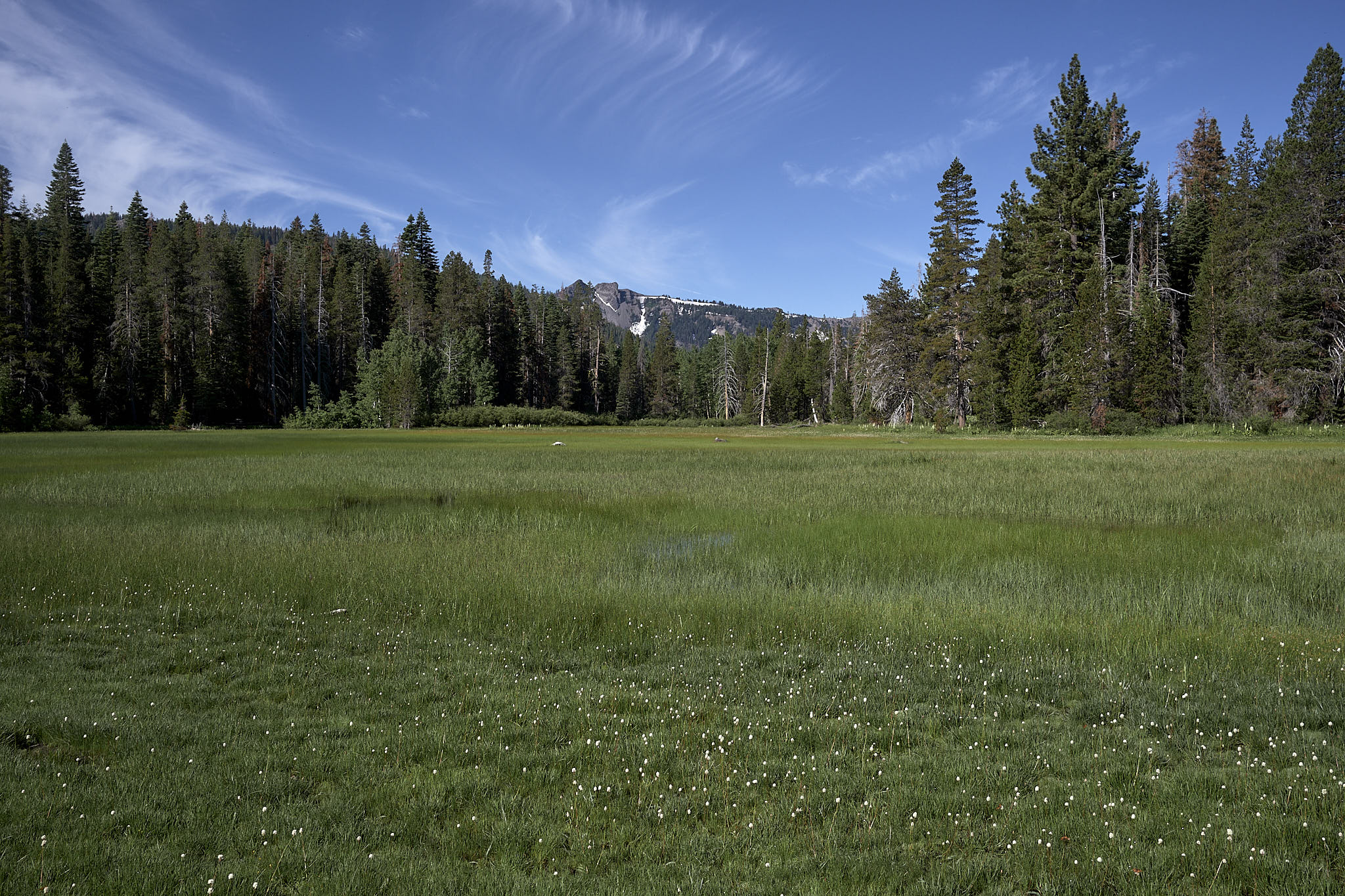
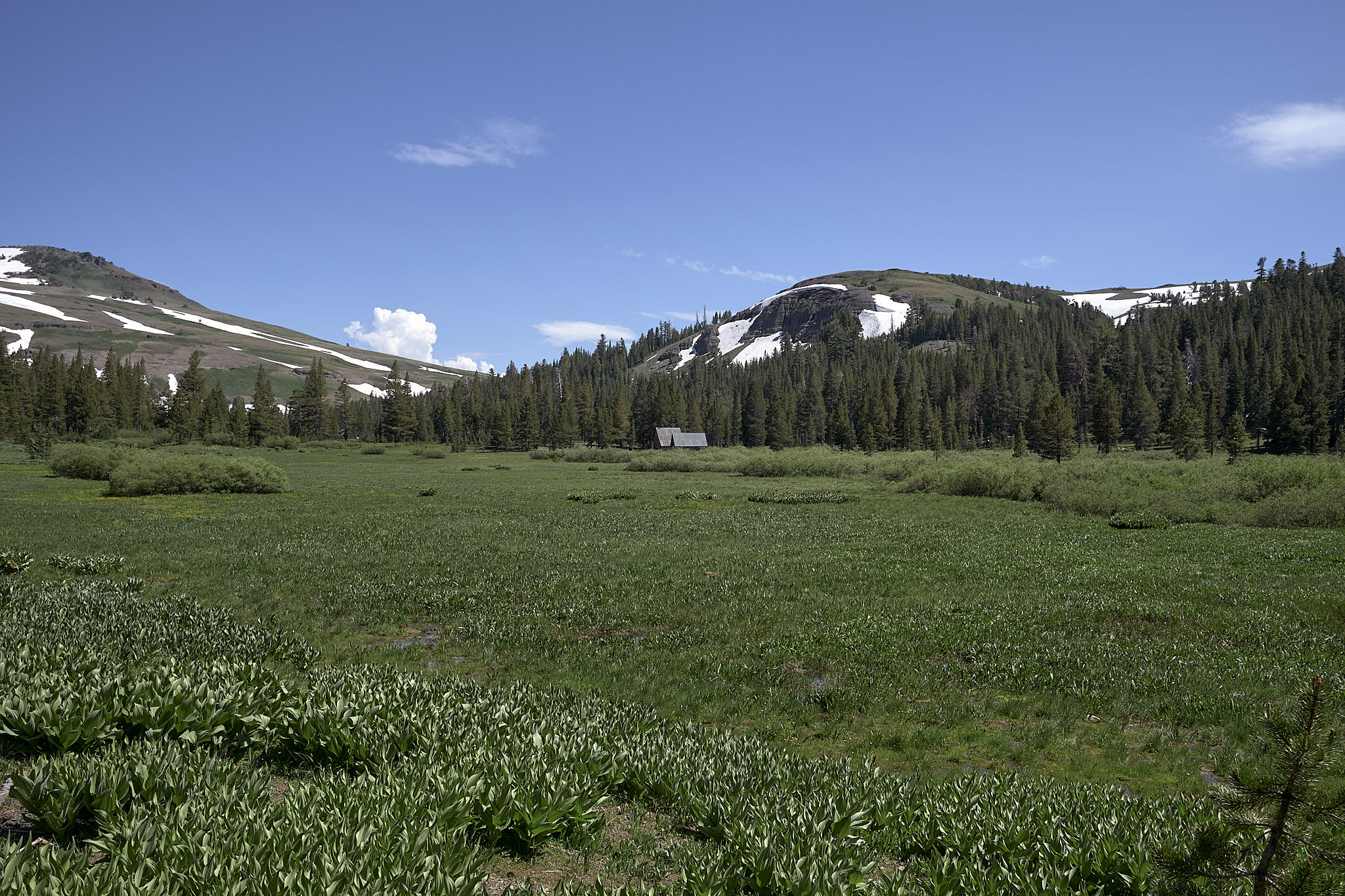
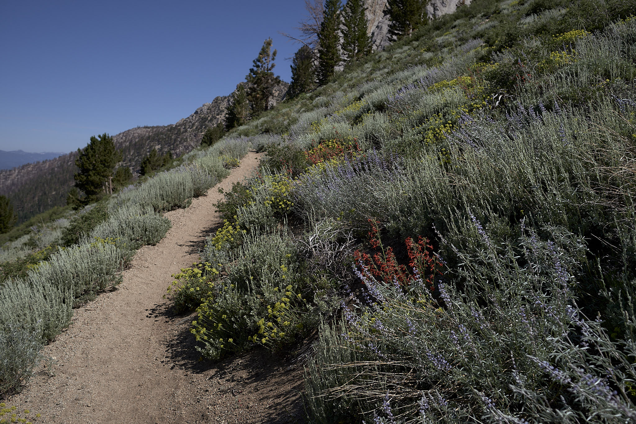
easy hiking this day. some beautiful mountain side meadows. there was a little snow, but nothing of import really.
as i was hiking this day there were numerous reports from clockwise hikers of this nasty, precarious snow bridge across a raging creek. needless to say, i was a little anxious about this thing. not too anxious as i’d already had my share of precarious snow slopes and climbs and descents. i couldn’t imagine it being anything worse than dick’s pass. so, i hiked on not really thinking about it until some hiker crossing my path would remind me. i crossed one creek with little to no snow. some couple of miles later i came across a patch of snow that i had to walk up, then drop down about 3 feet into a creek. no big deal. i was still looking for this raging creek with a snow bridge. a couple hundred yards after this second creek, a hiker and i passed. she asked me how bad the snow bridge across the creek was.
“you haven’t passed it yet?” i asked.
“no,” she replied. ”
“well, it must be that creek right back there. but, it was no big deal. there is no snow bridge. just hop up on the snow bank and walk across,” i said.
we talked about this for a minute or so and then she inquired if i had the farout app. i replied that i did not and this was one of the reasons that i didn’t. crowd sourced data is quite often erroneous or at least old. why worry about something that isn’t there? and if it is there, why worry about it until you get there and see the thing yourself? i will admit there are times when real danger presents itself in the way of a massive storm or fire or some other natural event and real time factual information would be helpful. if you like social networked hiking, by all means use it. i don’t. so i don’t. i get all the helpful and non-helpful information i need from the people right there on the trail.
as a parting gift, she informed me that the trail was pretty much clear of snow from where we were standing all the way to tahoe meadows, which was my destination. for all intents and purposes, she was correct.
luckily, the trail did not cross this snow field. it was indicative, however, of many that i had crossed.
daily mileage total: 31.3
trail total: 151.4
day 7 (6.5)
the last and final day. nothing much going on this day other than typical hiking. originally, i had planned to stop a couple of miles short of tahoe meadows, camp for the night, then finish up the last couple of miles the next morning. i thought better of it and decided to go ahead and finish the whole thing in one day. it was my longest day of the hike, but i finished it easily.
this was the driest section of the whole trail. i got a liter from spooner lake and it was bar none the worst tasting water i have ever had from any pond, lake, river, stream, or creek. someone asked me about it. they said that they heard it tasted like men’s deodorant smelled. i could not confirm that, but it definitely tasted like bad pond water. i was down to my last sip when i came across a snow melt stream just a little north of marlette campground. i had to backwash my sawyer filter because the taste had infected it. it took several good flushings to mostly clear the offending flavor.
cold, clear, filtered snow melt water. ah, the simple pleasures to be had while hiking.
i did run into one situation where i was crossing a snow field and the trail disappeared. no problem. i pulled out my phone, opened caltopo and started following the track. very, very soon i realized that something was amiss. there were no footprints or bike tracks in the sand in the trail. and then suddenly, there was all this detritus that had obviously been placed in the trail to prevent people from using it. i double checked my map and confirmed that i was indeed on the mapped trail.*
“well, i’ve got to come out somewhere,” i said to myself. and i did about a half mile later. right next to a sign saying that the trail had been re-routed and that old trail was closed. well, why didn’t they have a sign for the folks going counter-clockwise? ah well. it would not have been a problem had the trail not been hidden by snow.
i hiked into tahoe meadows that night at 2130. it felt good to be done.
*i double checked my route when i got home by reloading the gps track provided by the tahoe rim trail association. the gps track plotted perfectly on top of my route, which meant that the trt assoc track had not been updated. that thing is a whole other story. it is a mess.
daily mileage total: 34.0
trail total: 185.4
notes
the official trail length is 165 miles, i believe. at least that is the distance on the tahoe rim trail association website. if you add up all the miles on the segment maps provided by the trt, it’s 173.6. i can account for about 7 or 8 miles of the 185.4 that are not “trail”. so, i’d say the trail is pretty close to around 175 miles or so. that was the distance i used for my original planning.
if i had it to do over, i might consider taking microspikes. might. i’m not sure they would have sped things up overall as i would have had to stop to put them on and take them off numerous times. but, they could have reduced the number of butt pucker moments i had while traversing some of the snowy slopes. then again, they may have installed a false sense of security and caused other problems. who knows. as it was, i was very slow and cautious on any snowy slopes.
were it not for the snow, i would have easily finished this hike in 5.5 days.
i finished the trail with what i would describe as a good bit of food leftover. i had an entire unopened pack of shelled pistachios. pretty near all the pecans. one bag of the dried kale. about one dozen various bars. and just a little honey.
things i enjoyed eating while hiking: honey stinger waffles, pistachios, string cheese, fritos, honey, tuna creations packet with beans and rice, archer original beef stick.
things i tolerated eating while hiking: nature’s bakery fig bars; this bar save lives-vanilla, almond, honey flavor; made good krispy square
things i went “uuggghh” to eating while hiking: everything else that i packed.
as i had to add another day, i did stop at tramway market in the heavenly resort to purchase a couple of ramen packets, some string cheese, and another bag of fritos. i also got a burrito and root beer which i consumed while hiking back to the trail.
hitch hiking is illegal in nevada. the morning after i finished, i was standing on the side of the road with my thumb out. i hadn’t been there more than about 5 minutes when a cop came rolling up the highway. “no hitch hiking. illegal” he blares over his speaker without even slowing down. i never would have imagined in a state where prostitution and gambling are legal that hitch hiking would not be. i summoned an uber.
by a large margin, there were more women hiking the tahoe rim trail than men.
desolation wilderness was definitely the highlight of the hike. not that the rest of the hike was not scenic or beautiful, but the lakes with the snow and ice were just gorgeous. for that reason alone, all the snow was definitely, unequivocally worth it.
i never saw or heard a bear.
without exception, each morning i woke between 0500 and 0530. no alarm or anything. i was usually hiking between 0600 and 0630.
This still scares me for you to be all alone! I’m happy for you that you find joy but … you know me!!
there are always some people around. haven’t done any hiking in wilderness routes yet. all well established trails thus far.
Lovely reading. The pictures are fabulous. I’m so happy you were able to go.
thanks. and of course, pictures never do the scene justice.