
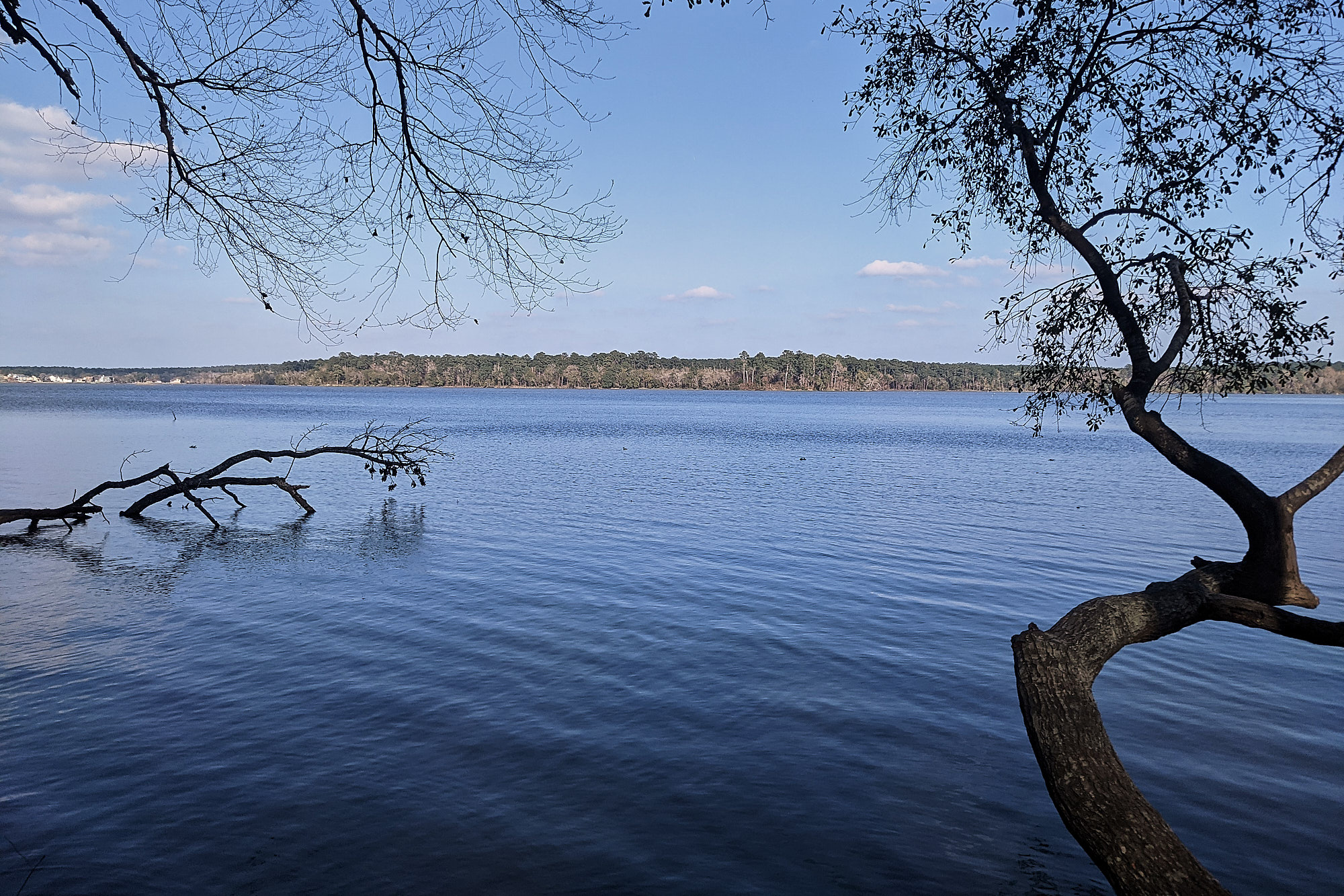
the only real view while on the lsht: lake conroe at mile 16.5
i set out from mile 0 at exactly 1000 on sunday, december 26, 2021 with the goal of completing the entire trail in 3 days. hunting season meant that i had to stay in established hunter camps along the trail. no legal stealth camping. going over the maps, the logical 2 stops were at mile 28.5, just off cotton creek road, and then just before mile 60 on forest service road 202d. my daily mileage would have to be 28.5, 31.5, and then a long 36.5.
now, i know what you’re thinking: “you’ve attempted to thru-hike this trail two other times unsuccessfully.” yes, you are correct. “30 mile days. hahaha. you were dying with 12 mile days.” again, correct. but, i’ve learned a lot since those hikes.
this hike was in preparation for my return to the appalachian trail to complete the last 600 miles. i had a new backpack and a new tent. i wanted to test them both to make sure they worked for me. plus, i just really like hiking.
i won’t keep you in suspense. i completed the entire trail in 2 days 10 hours and 30 minutes. i stepped off the trail into the winters bayou trailhead on fm 1725 at 2030 on monday, december 28, 2021.
the hike
day 1 – sunday, dec 26, 2021 – mile point 28.5
i was using the maprika app for this hike instead of the paper maps. i did bring the paper maps with me in case maprika crapped itself. the only time i really needed maps was for road walks. otherwise, the trail is pretty well blazed (with some exceptions) if you are paying attention. i could not have asked for better weather. it was warm for december, but still pleasant. much better than summer. the trail was in good condition and i was able to hike along at roughly 3 mph. i started hiking with my trekking poles as i always have. after a few miles, i had to stash them on my backpack. they weren’t helping and were actually slowing me down. i thought that was odd, as i felt they had always assisted with my pacing. clearly no longer the case. for the rest of the hike, the only time they came out was to pitch my tent.
a few short road walks, otherwise, these sections are nice. there were plenty of natural water sources along the trail. the stubblefield road bridge was rebuilt. it was nice not having to take a bushwhack route around. i got to hike past lake conroe and get that nice view. lots of people out for day hikes. more than i’ve ever seen.
i rolled into what i thought was the campsite around 2000. as i approached, i saw a light turn on. someone else was there. i approached and said “hello”. a female voice responded. i asked if she would mind if i pitched my tent at the the edge of the site away from her. she responded that the actual campsite was about 100 yards up the trail. i got the message, said thank you, and kept hiking. indeed, the campsite was a short way away. stepping into it off the trail i remembered staying there on a previous hike. legs and feet were tired and sore, but not overly sore. the good kind of sore from a solid workout. i made camp, ate dinner, then promptly fell asleep somewhere between 2030 and 2100.
day 2 – monday, dec 27, 2021 – mile point 59.9
woke up at 0600. surprised how good i felt. no real pain or stiffness that wasn’t normal. ate breakfast, broke camp, and started hiking around 0700. a couple of long road walks this day. i hate road walks. most hikers do. lots of construction around i-45. state park road 40 east of 45 was basically dirt. cars and trucks driving 50 mph kicked up so much dust. i pulled out my pak towel, wet it, and wrapped it around my nose and mouth as a dust mask.
had one backtrack through a swampy area where people blazed their way around a muddy area. i inadvertently turned it into a loop. walked about 100 yards back the way i came then realized what was going on. no problems with water this day either. plenty of it in creeks and streams. got to the forest service road to take me to the night’s camp about 1830. guidebook said it was 100 yards down the road. i turned right and started walking. 200 yards later . . . uuggghhh . . . must be the other direction. got to the camp site. dropped my pack and walked around looking for a good tent site. the adrenaline from the hike was subsiding and i was starting to feel the effects of two extremely long days. only one raised tent pad. it was too small to easily fit the length of the protrail. best place was right next to it. made camp, ate dinner. legs and knees were feeling it this night. calves were really tight. especially the right one. also felt a lot of pressure inside the right knee.
about 2000 or so i was on the verge of sleep and a light in the woods got my attention and i sat up. it was sweeping around. “must be looking for the camp,” i thought. it disappeared and i laid back down. what seemed like forever later (really just a minute or so) and a light from the other direction. again the sweeping and then it disappeared. I sat up not sure what was going on. a minute later, on again and closer. i saw the light sweep the camp site and then hike a few yards past, then i could hear crunching as the person walked into the clearing further up. i got out of my tent and said there were much better tent sites closer to me. the light shown at me.
“are you sure?”, he questioned.
“absolutely. there aren’t very good sites over there. the tent pad is right here and empty,” i replied.
i heard some rustling and the light headed my direction. he surveyed the pad and then dropped his pack.
“thanks,” he said. “i saw your tent and was trying not to disturb you.”
“appreciated,” i said. “you are welcome to use your white light and do whatever you need to do to set up your tent. don’t worry about noise or anything. i’m going to crash and then i’ll be out.”
i crawled back in my tent and didn’t wake until the morning.
day 3 – tuesday, dec 28, 2021 – mile point 96.5
woke up again around 0600. was feeling ok. made some breakfast: a protein granola bar crunched up in some oatmeal. i really enjoy crunchy granola bars crushed in my oatmeal. i had purchased “protein” granola bars. they were on clearance and cheap. when i see “protein” in the description, i know it’s “sawdust”. the price enticed me into the purchase. i couldn’t eat all the breakfast. sawdust it was. i dumped about a quarter of it in my trash sack. “stupid,” i called myself for being baited by the price and biting. I quietly packed up my stuff and just as I was finishing, my camp partner popped out of his tent. this was at 0700.
we spent the next hour talking tents, trails we’ve hiked, strangers in the dark, trail food. he had hiked 25 miles the previous day. thought the campsite was further down the trail instead of on the road. he realized it wasn’t, hiked back, walked around looking, and then saw my tent reflecting in his light and realized where the camp site was. at 0800 i bid him adieu and wished him luck on his hike.
my legs were really tight as i started hiking. i stretched often through the day, but the right knee was building pressure. the top of the calf immediately behind my knee was becoming extremely sore. tendonitis it seemed. but, who knows. i tied my pak towel around it as a sort of ace bandage. it helped and i kept hiking.
a long 5 mile road walk made the knee and calf worse. not bad, just really, really uncomfortable. at mile 71.1, i had to cross the east san jacinto river. the bridge has been gone since harvey. last hike, the river was way high and i had to crawl across a pine tree that fell across the river. luckily, the river was low and I could simply walk across.
mile 80, i began to really feel it. 16+ miles, or 5.5+ hours, to go. 1800 and the end of daylight. the last 10 miles or so were really poorly marked. i recall them being that way the last time i hiked that section. adding to that was the fact that the trail was extremely wet and muddy. this created a bit of anxiety which can be described as, “am i still on trail or not?” syndrome. it was extremely wet last time, but i had hiked it in the daytime.
my right calf and knee had grown gradually worse over the past miles. they became visibly swollen and painful. there was no option but to finish. jodi was waiting at the end. i recall seeing a marker for mile 94 or something. one of the few in the section. it meant the end was near. i picked up my pace, despite the pain. the adrenaline was helping to push through it. mile marker 95. closer. i never saw one for 96.
soon enough i noticed the trail starting to open up. that meant the trailhead parking lot. i turned my light to its brightest setting and waved it around in circles. i saw headlights turn on through the trees though i couldn’t see the end. i hobbled faster. then . . . the parking lot.
i stopped and looked at my phone. it read 2030.
the car sat 30 feet away. the walk to it felt like miles.
mountain laurel designs burn dcf backpack
after having carried my ula circuit for close to 2000 total miles, i was looking to have a pack that would ride a bit higher and hopefully have the bottom nestle somewhere at the bottom of the small of my back. this would also make the “hip” belt become more of a “waist” belt. i also no longer needed the volume that the circuit offered and my total pack weight is typically well under 25 pounds.
after hours and hours and hours and then more hours of researching just about every cottage backpack manufacturer out there, i pulled the trigger on the mld burn backpack. mld recommends the large torso size for someone my height. i went against mld advice and ordered the medium. i was pretty confident it would work. these packs are made to order. the dcf version, which they discontinued and replaced with ecopak ultra immediately after mine was delivered, was a very steep premium from the regular fabric they offer. and the lead time was 16 sixteen weeks. that’s not a typo. it was 16 weeks.
i chose dcf because it is inherently water “proof”. my circuit would add a pound, if not more, of weight absorbing water when it rained. not fun. i’m not really looking for a dry bag, i just desire something that’s not going to add significant water weight in inclement weather. and i hike in a lot of rainy/stormy weather.
in my 3 days of hiking the lsht, i was pleased with how the burn performed as far as its fit and ride on my back. the medium was the right choice. not sure about the non-stretch front pocket yet. i liked the spandex-like front pocket on the circuit. the burn front pocket is made from dcf which doesn’t stretch at all. this sort of limits what all can go in.
tarptent protrail li
this is the same tent design that i was using, just in dcf. you can read my review of the protrail here. the last line of that review reads, “a dcf protrail with a higher bathtub floor to reduce the misting in heavy rain might just be the ticket.” i don’t think the bathtub floor is higher, but it is dcf.
can’t speak to rain proofness yet, but i can say that i had zero condensation on the two nights i used it. none. nada. outside or inside. the second night, the guy pitched next to me was in a sylnilon tent. in the morning he had condensation all over his tent. i had nothing at all.
sylnilon absorbs water and then starts drooping. dcf doesn’t. no sag equates to more headroom inside as well as pitches that stay taut in all conditions.
the major downside to dcf, again, is the price premium. i did purchase a “blem” protrail that supposedly has some fabric imperfections that saved me i think $50. after several nights on trail there are going to be imperfections so that does not concern me. a second consideration is that “stuffing” dcf is not recommended if you want it to last. the tent needs to be folded and then rolled. i’m seriously going to miss being able to just “stuff” my tent into its sack. but, if that is the only trade-off, i’ll take it.
additionally, since i didn’t use my trekking poles to actually walk, i have replaced one trekking pole with the 24″ rear pole that tarptent sells as a trekking pole substitute. that means, i’ll be carrying only one trekking pole with me on upcoming hikes.